On previous trips I'd noticed fossil shells (? Pliocene) at locations quite far inland and I thought that might be the basis for a project around sea level change, and/or tsunamis. The first few free days were spent, besides reccying locations for the trip, in searching for more shells to see if there was sufficient data to work with.
 |
| Tindaya Plains |
 |
| Limpet shell - Tindaya |
 |
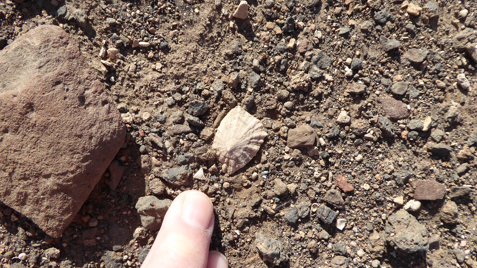
| Ventral view of Tindaya limpet |
We found more of these shells in the original locality (in the centre of the first image), often cemented into the caliche/calcrete surface deposits, and with caliche deposits on them.


Moving away from the original area we searched thoroughly for more but, disappointingly, found none. It seems possible that the shells are kitchen midden deposits from prehistoric settlement on Tindaya's lower slopes.
On another day, further south, we explored the area to the east of Tuineje which is flat, and caliche covered, surrounded by flows from prehistoric cinder cone eruptions.
This flat-lying area is covered with sandy material, with the buff colour characteristic of caliche.
 |
| The flat Tuineje Plains |
 |
| Lava flows at the edge of the flat plains, and a cinder cone in the distance |
 |
| Clasts cemented by caliche |
 |
| The only shell we found |
Introduction
Thick layers of caliche (calcrete crust) are widespread on
Fuerteventura and Lanzarote, the easternmost, closest to the African mainland,
and most arid of the Canary Islands. This is highly unusual on oceanic volcanic
islands composed of mafic/ultramafic igneous rocks, where there is only sparse
carbonate sediment as a source for calcium and magnesium carbonates. Caliches
are important to the islands, contributing chemical elements to soils. Caliche
source(s) may be finite or continuing; they may be climate (wind and/or
temperature) or sea level dependent. Materials can be fingerprinted, and
sources identified, using metal isotope ratios as well as major, trace and REE
analysis. If material availability has varied significantly over the islands’
20 Ma history, it is likely also to vary in future, with implications for
retaining present soil, vital to the island’s agriculture, and for replacing or
augmenting this soil.
Research question
This study will use
metal isotope ratios to assess past and present sources of supply of carbonate
and associated materials to caliche on Fuerteventura and Lanzarote, Canary
Islands.
Null hypothesis: There has been no change over time of the
source of carbonate material supplied to Fuerteventura and Lanzarote, Canary
Islands.
No comments:
Post a Comment