Labels

A'a (3) Aberystwyth (2) aerial ropeway (1) Afon Llia (1) Agua Amarga (1) alcazaba (1) Alcmonavis (2) Alcogida (1) Alicante-Cadiz fault zone (1) alkali basalt Tallante lherzolite hornblende xenolith (1) almagre (1) Almagro (1) Alpine orogeny (1) Alpujarride (1) Alte Schule Biergarten (1) Altmuhltal (1) ammonite (1) Andalucia (2) antequera (1) aquaduct (1) Aranjuez (1) Archaeopteryx (1) Ardales (1) Arundel (1) Aumuhle (1) Ballaison (1) Bandas del Sur (1) banos de montemayor (1) Barbary Ground Squirrel (1) barrier island. OUGS (1) basin (1) basin range gypsum karst dacite amhibole ibex (1) Bath (1) Bavaria (1) Bayuyo (1) beaconites (1) Bentham (1) Berger Museum (1) betics (1) Bideford (1) big rivers (1) Bilbao (1) Bovey (1) breccia (2) bridge (1) Brownstones (1) building stones (2) bunte breccia (1) Burgermeister Muller Museum (1) cable car (1) Cabo de Gata (2) Caen stone (1) Calatrava (1) calcarenite (1) calcrete (3) Caliche (1) caliphate (1) Caminito del Rey (1) Canterbury (1) carbonate sand (1) carbonatite (1) Carboniferous (5) Cardiff (1) casa de las columnas (1) Casa de los Coroneles (1) Castillo Santa Catalina (1) castle (1) cathedral (2) cathedral. (1) cave (1) cavern (1) cenozoic (1) central volcanic province (1) Chablais (1) chalcolith (1) channel (1) Chedworth (1) chromite (1) church (1) Clypeus Grit (1) coal (1) coesite (1) columnar joint (1) Conduit House (1) conglomerate (1) contact (1) contact aureole (1) copper age (1) Cornford (1) Craig y Fro (1) Cretaceous (3) cross cutting (1) cuchillete (1) cuchillo (1) cuenca (1) Cueva de los Llanos (1) CVP (1) dacite (1) Daimiel (1) Daroca (1) Dazu (1) despenaperros (1) Devils Elbow (1) Devon (1) Devonian (1) Dingle (1) dinosaur (1) Dinosaur Park (1) diopside (1) dolmen (1) dolomite (1) dome (2) dorsal ridge (1) dragon (1) dune (1) dunes (2) dyke (2) dykes (4) Eaux Chaudes (1) Eco-Museum (1) Eduard Opitsch (1) Egyptian Vulture (1) ejecta (1) El Cotillo (1) embalse (1) Eocene (1) epidote (1) erratic (1) fan (1) Faro (1) fault (1) fiesta (1) Fishbourne Roman Palace (1) flank collapse (1) flatiron (1) Flint (1) floods (1) fluvial (1) fold (2) folding. (1) fossil (1) Fossilien Besuchersteinbruch Muehlheim (1) Fossilien und Steindruck museum (1) France (1) Fuente De (1) Fuerteventura (11) Fuerteventuran Chat (1) gabbro (1) garnet (1) Gaspe (1) geology (16) geology Carboniferous limestone joints calcite Mumbles Limeslade (1) geology rodolith Messinian Almeria (1) Geopark (2) giralda (1) gneiss (2) goats (1) gorge (1) Gower (1) granada (1) Granada Basin (1) granary (1) granite (4) granite enclave (1) granodiorite (1) graphitic mica schist (1) Great oolite. OUGS (1) greater spotted cuckoo (1) Gryphite (1) Guimar (1) Gully Oolite (1) Guzenhausen (1) Haardt Quarry (1) Haitzalde (1) Harthof (1) Hemerdon (1) High Tor Limestone (1) Hisn-ashar (1) hispania glass (1) hornito (1) hoya de la mora (1) huetor tajar (1) hyaloclastite breccias (1) hydrothermal (1) ichnofossil (1) igneous (1) ignimbrite (2) impact (1) industrial archaeology broomrape scoria schist Mazarron (1) Inferior oolite (1) internal zone (2) Interpretation Centre (1) Ireland (2) Isla de Lobos (1) Iznajar (2) Jack Matthews (1) Jaen (1) James Jackson (1) Jandia (1) Jane Francis (1) Jardin del Principe (1) Judges Lodging (1) Jurassic (4) karst (2) Katherine Cashman (1) landslip valley (2) lapis specularis (1) Laruns (2) lava tube (2) Lavernock (1) Lawrenny Cliff Fm (1) Leon (1) lime kiln (1) limestone (14) lizard (1) Loja (1) Loja karst flowstone calcite crevillente fault (1) Lower Limestone Shale (1) Lundy lundyite geology OUGS (3) mafic dyke (1) magnafacies (1) Magnesian (1) Malaga (2) malpais (2) Malvern (1) mantle (2) map (1) marais (1) marine abrasion platform (1) Mark Williams (1) marl (3) Marquise (1) Mary Rose (1) Mary Tourtel (1) marzipan (1) Mercia Mudstone (1) Mesa Roldan (1) Mesozoic (1) metabreccia (1) metagranite (1) microgranite (1) migmatite (2) mine (1) mineral railway (1) mineralogy (1) Miocene (1) Molina de Aragon (1) Montejaque (1) mud cracks (1) mudrock (2) Munich (1) museum (1) Mutriku (1) Nasrid (1) National Museum of Wales (1) neolithic (1) Nevada (1) New Shipping Fm (1) Nordlingen (1) Notgrove (1) NW ridge (1) ocean crust (1) Ogmore (1) oil reservoirs (1) Old Red Sandstone (4) olistostrome (1) Oliver Rauhut (1) olivine (1) oolite (2) orchid (1) ordnance factory (1) organ (1) Otting (1) OUGS (23) Oxford Colloquium (1) Oxford Geology Group (1) Oxwich Head (1) pahoehoe (1) Palacio Real (1) Palaeocene (1) Palaeontology (1) palaeosol (2) palagonite (1) panopticon (1) Parador (1) Pembrokeshire (1) Penderyn. (1) penitentes (1) Pennant (1) peperite (1) peridotite (4) pierre a martin (1) pillow lava (3) pineau (1) Poblado de la Atalayita (1) porca (1) Portalet (1) Portishead (1) Portland (1) Portsmouth (1) Portsmouth Historic Dockyard (1) Precambrian (1) president (1) Presteigne (1) Puerto de Pajares (1) Purbeck Marble (1) pyramid (1) pyroxenite (1) Quarr (1) Radyr (1) Ragstone (1) rain drops (1) rainbow (1) raised beach (2) rambla (1) rapakivi (1) reefs (1) retrograde (1) rhodoliths (1) Rhone glacier (1) Richard Fortey (1) Ries (1) rif (1) rift arm (1) ring complex (2) rio genil (1) rock tomb (1) rodoliths (1) ROF (1) rojas rojos y violetas (1) roman (1) Roman brick (1) romanesque (1) Ronda (4) Roques de Garcia (1) Ros Rickaby (1) Ross on Wye (1) Rotherwas (1) Rovoree (1) Saintes (1) Salamanca (2) Salinas de Carmen (1) salt (1) San Pedro del Mar (1) sandstone (5) Santa Elena (1) Santander (1) Santillana del Mar (1) Santonian (1) scarp (1) scoria cone (3) Scrivener (1) sea-level (1) seamount (1) seamount series (1) sediment (2) segobriga (1) Senni Fm (1) Serrania (1) Severnside (5) Shamhaupten (1) shell filling (1) shield volcano (1) Shipway Limestone (1) Shoemaker (1) Shoestring Volcanoes Tenerife Lanzarote Fuerteventura Almeria Guadarrama Norway Sweden Newfoundland Gaspe Alps Pyrenees (1) Sierra Elvira (1) sierra nevada (1) Sierra Subbetica (1) Sierras Subbeticas (1) sika deer (1) Silurian (1) smoky quartz (1) snow (1) soplao (1) Southsea (1) spa (1) Spain (5) St Augustine's (1) St Georgskirche (1) St Martins (1) St Mary's Well Bay (1) staddle stone (1) stalactite (1) stalagmite (1) Stapleton castle (1) Storey Arms (1) storm (1) strombus (1) subaerial (1) subbetic (1) suevite (1) Sully Island (1) sunrise (1) syenite (2) syncline (1) Tears Point Limestone (1) Teide (1) Teno massif (1) Thanet Sandstone (1) Threlkeld (1) Toledo (2) Torrecaballeros (1) torrejoncillo (1) Torrox (1) Townsend Tuff Bed (1) transgression (1) travertine (1) tres reyes (1) Triassic (2) Trigonia Grit (1) Tufa (1) Tuff ring (1) ultra-K volcanic (1) unconformity (7) Vega ring complex (1) vesicles (1) Vidiago (1) virgen de las nieves (1) Virgen del Mar (1) visigoth (2) volcanic (1) volcano (2) Wales (4) walk (1) Warren House (1) wetland (1) wolfram (1) WWT (1) xenolith (1) zamora (1)

Sunday 16 October 2016

The Old Red Sandstone in the Brecon Beacons (and some Quaternary topography)

There are probably more erudite accounts of this day, not least in the OUGS Severnside's next newsletter, the Sabrina Times. However, this is my own version of an interesting day out. Hopefully it is accurate as far as the geology goes (although by no means as comprehensive as Norman's newsletter report will be!) although with name changes going on it is quite hard to get your head round at times!

We met by Craig y Fro quarry, just down from the Storey Arms heading north where we were not viewed too favourably by the man in the burger van who thought we were taking up parking that his potential paying customers might use during the day!

John began by telling us the tale of how he had noticed pebbly conglomerates in the Beacons and knew there were pebbly beds in the Brownstones Formation in Pembrokeshire so he was keen to explore the area and work out links between them if possible.

Stop 1 - Craig y Fro quarry

Heading across the busy main road to Craig-y-Fro quarry
This quarry in sandstones and mudstones of the Senni Fm (below what was known as the Brownstones) provided research material for Dianne Edwards into the early plant fossils for which it is famous, and also for David Attenborough's Life on Earth series. These fossils are of small, branching, plants which have been carbonised. Unfortunately the site was over-collected in the 1960s and, to provide more material, the upper left hand corner had to be dynamited. It is now a Site of Special Scientific Interest (SSSI) and no collecting is allowed
The back wall of Craig-y-Fro quarry
 The back wall of the quarry shows a series of mudrocks/shales, and sandstones, and we were warned by John about the very slippery nature of the shales, particularly where they crop out in the stream bed! As an aside, a friend told me that their MRT used the waterfall for ice climbing practice!
Exposure on the north side of the quarry
The exposure includes a series of channels, filled at their bases with mudstone and calcrete clasts which have been eroded from the previous channel cycle. This channel series passes upwards into mudstones; the top of the sandstone has been shown to have plant fossils, and is particularly rich in large mica flakes, maybe 1 mm.
Cross stratified channel sandstone

Many of the mud clasts have eroded out, leaving holes. Calcrete clasts show white

A bed formerly rich in mud clasts (now eroded).

Military road north of Storey Arms

At the top end of the road, by the start of the Corn Du path, John gave us a mini-talk about the Lower Devonian Senni Beds/Brownstones "transition". A few points from it:
John Davies explaining the geology to us
  • This boundary was, historically, described as transitional, even though it was placed on a conglomerate lithology, by reason of a gradual colour change from green up to maroon in the Senni Beds.
     
  • The conglomerate contained exotic clasts
  • It used to be said there were no fossils in the Brownstones but in fact this is "no body fossils" (plants and animals) since there are Beaconites burrows.
  • The earlier Senni Beds have all sorts of Euripterids etc but are then topped by the conglomerate body. The Senni Beds are in a discrete block and may represent an area with a microclimate. The bed of coarse clastic material runs across from here to Ross on Wye and the Lower Brownstones there equate to the Senni Beds elsewhere (you can't tell them apart by colour)
At this point he broke off to describe the landscape in terms of its geology. Looking south we could see the Upper Devonian Plateau Beds at the top of the hill. Easy to see how they got their name!
The arm of the signpost is carefully aligned to point out the Plateau Beds on the ridge. 
Looking back north towards Craig-y-Fro we could see the gently southward dipping beds of sandstone and mudrock. These are broken by normal faults, downthrowing to the north. As I'm in the middle of working through a case study of the Book Cliffs in Utah I could see some similarities, despite the lack of exposure here! Another member of the group could as well but we aren't sure if we can carry the analogy very far since these are apparently interpreted as fluvial rather than marine/littoral deposits so it is hard to see how flooding surfaces, sea level rise and fall, sediment partitioning etc could apply here despite that superficial resemblance.
Beds of sandstone and shale above Craig-y-Fro
 He also described the hummocky terrain left in the valley bottom after the last glacial.

Looking north down the valley towards Libanus - the hummocky, stream incised valley fill is glacial material 

Location 2 - on the old Military Road north of the Storey Arms

We walked down the old road, past a quarry, with a good view of the exposures above Craig-y-Fro. Eventually we came to some small exposures of conglomerate in the path. This is the Lawrenny Cliff Fm which lies directly over the Senni Fm. The fabric shows matrix support and the clasts have been identified as from Mid-Wales, though some are very rounded and may be reworked.
Two identifiable conglomerate beds can be mapped from Pembrokeshire, through the Beacons, to the Ross on Wye area, in what used to be called the Brownstone Group.
Examining the conglomerate on the Old Military Road

The variety of clasts can be seen
From here we can see exposures up the hillside to the west which are the New Shipping Fm, a slightly younger part of the "Brownstones". More of that later.

Lunchtime

The afternoon stops were to be in the next valley west, so, since the Brecon Mountain Centre lies conveniently on the route, we went there to eat our lunch though, sadly, only the cafe/loos were open. However, the sun came out and we were treated to lovely views east to the high Beacons.
Brecon Beacons from the Mountain Centre on a beautiful October day!
Once again John described the connection between the landscape and the geology though unless you are on the spot it doesn't mean a lot! Except to say that between us and the Beacons the ridge is Senni Fm, topped by Lawrenny Cliff Fm

Location 3 - Above the Devil's Elbow

Amazingly we kept the convoy together through a number of left and right turns, negotiated the bends of the Devil's Elbow without damage to us or a campervan coming the other way, and arrived at yet another place with splendid views north.

A major feature here is the valley on either side where the Swansea Valley Disturbance cuts through from SW to NE whilst we are standing on crags of Lawrenny Cliff Fm.
The Carreg Cennan disturbance runs across below the distant skyline and the Swansea Valley disturbance from the valley top right across to the valley below us on the left.

Cross stratification and slumping in the Lawrenny Cliff Fm above the Devil's Elbow
And a close up - hard to see through the lichen but there is at least one well rounded quartz pebble!
 From here we continued over the watershed to the south then and stopped by the Afon Llia to look at exposures of the overlying New Shipping Fm which can clearly be seen dipping south here, in the same direction as the stream is flowing.
Last stop of the day by the Afon Llia, looking north, upstream
Bedding planes dip south, downstream, creating a series of water slides

Beds of the New Shipping Fm can be seen clearly in the far bank

And here, in the near bank.
So, having completed two transects under John's expert guidance, through the south-dipping beds of the north crop of the South Wales syncline, we headed home. Well not quite home as the chance of being near the whisky distillery at Penderyn seemed too good an opportunity to miss for a few of us!

According to their website, "‘Distilling in Wales was a lost art...’
But in the late 1990s in a pub in a small post-industrial Welsh valley town, a group of friends drank and chatted about establishing the first
whisky distillery in Wales in over a century. They dreamt of creating a whisky as pure and precious as Welsh gold, represented today by Penderyn’s ‘gold seam’.
The "gold" seam on Penderyn's logo
The journey home should have been straightforward along the Heads of the Valleys road and through Abergavenny to the A40 but roadworks between Merthyr and there forced us to take an interesting diversion, winding our way through little villages and round steep, tight corners. An unexpected addition to a good day out.


Friday 14 October 2016

The two old bats head north "to the rocks"!

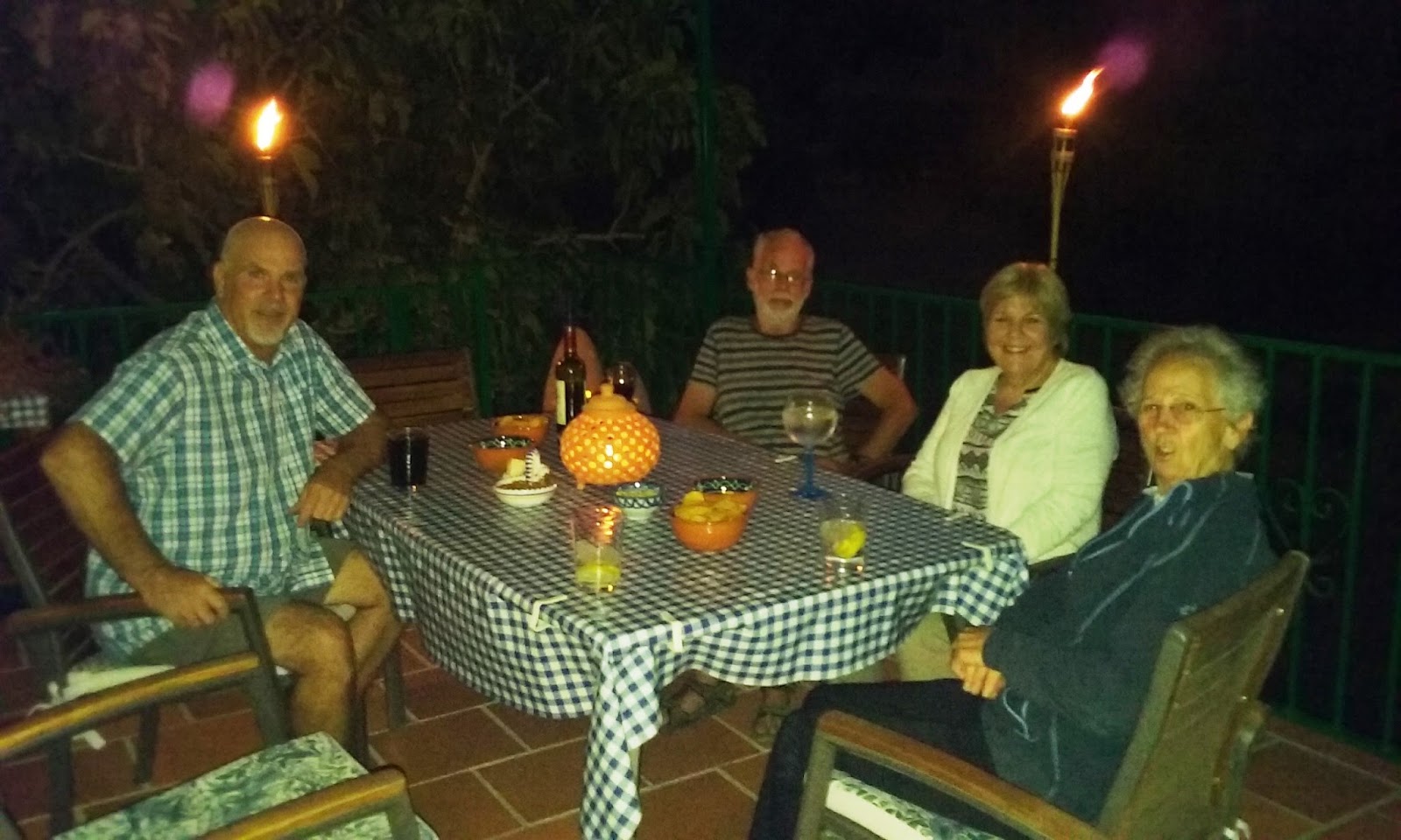
Time at La Paz was, sadly, brief as we had a long drive north, and wanted to see a bit more of Spain on the way so after an evening with Mick and Jayne, the next morning we packed up Susy Suzuki, said goodbye to the place and started back.
On Jayne and Mick's terrace
The first part of the drive is pretty familiar - Granada, Jaen, Valdepenas...  there are some lovely rocks to admire on the way though it isn't as scenic as it was before they rerouted the stretch north of Santa Elena to avoid the Desfiladero de Despenaperros!
One of the tunnels which cut through the seriously craggy bits

Pretty sure I've snapped, and posted, this lovely stack of colourfully striped rocks before!

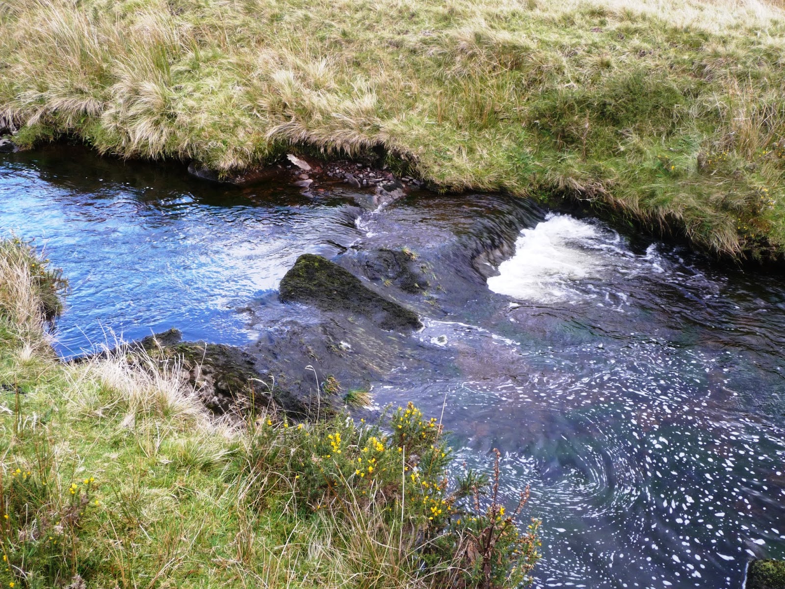
Nearing Jaen there are some massive beds of limestone in the hilltop crags. Also a Nasrid watchtower on the rocky outcrop above the main road!
Once north of the mountains we've climbed up onto the level plains of the "Mamba Country" (Miles and miles of B all) so there's little in the way of rocks to snap!
We wanted to get as far as possible that first day and decided we would go west around Madrid, turning off the main road north after Manzanares, past Consuegra (the hill with the windmills - this is Don Quixote land) and Toledo, in the direction of Avila. We'd spent a day in Avila some years ago and liked it, so it seemed worth a return visit. However, it wasn't to be: bypassing San Martin Valdeiglesias, we went over a roundabout onto the road to Avila and found out way blocked by smoke and flames!
A moment or two later the flames were leaping across the road!
We did a rapid turn around - there was no knowing how far the fire stretched on the far side of the smoke - and headed into San Martin for a restorative coffee, and parked up to eat our lunch. We found the road was still blocked off though and, checking the map, there was no obvious detour to get us to Avila so we changed plans and headed around Madrid, through San Lorenzo de Escorial towards Segovia instead. Although pretty - wooded and mountainous - it was quite a slow and circuitous route and we were glad when the Escorial finally came into sight heralding that we were at last getting somewhere. Even so, the road is still quite slow - this is Madrid's "countryside" and fairly unspoilt.
The Escorial is some way out of Madrid on the NW side
We passed Segovia in the late afternoon so we began looking for somewhere to stay and found it in Torrecaballeros a little way east. Finca El Rancho comprises an hotel, a posada (where we stayed), a restaurant, a wedding venue, a shop etc etc and is a converted farmhouse and buildings in the middle of this village. The downside was that the restaurant was shut that evening but there were several to choose from nearby and we found one that served a delicious revuelta with morcilla and broad beans in it! Plus grated apple on top. Delicious!
A pleasant view from the window of the posada towards the Sierra.
The revuelta was delicious - and what an inspiration to grate apple on top!

Overnight the rain came in and next morning it was wet,
though the rain stopped by the time we set off!
After a good breakfast with freshly squeezed orange juice (all in the room price) we continued NE towards the main N1 which goes to the north. The clouds were flowing over the top of the Sierra de Guadarrama as we drove - a beautiful sight!
Clouds spilling over the crest of the sierra, and down the side
After leaving the Sierra de Guadarrama we were back on the very flat, young sediments of the plains of Old Castile
Rather liked this quirky bit of reinforcement of a single soft bed in a road cut. 
Once north of Vittoria-Gasteiz the layer-cake geology gives way to some nice sensible mountains again
A thrust or onlap?
 We'd booked a B&B near Mutriku for the final night, called Haizalde. An interesting drive out of this little coastal town, along a narrow road, contouring around the cliffs, for a mile or so (always seems further when you don't know where you are going). However at last it came into view - an intriguingly modern building in a little coombe overlooking the sea.
Haitzalde

Parking is up above, and we had to take our bags down a zigzag path to reach the house

Lots of decking, both by the house and lower down but the rain put paid to any ideas of sitting in the afternoon sun enjoying the view
 No restaurant/food, although there was a very handy self-service area for drinks, snacks, coffee etc. There were three lots of people staying and we all ordered take-aways (tasty pizza and salad) from a pizza place in Mutriku, which turned up at 8pm, delivered by Hagrid's twin brother!
The rain stopped for a while next morning - we enjoyed a rather watery sunrise, and a wander down through the grounds to the cliff top, before breakfast. There's a grassy, zig-zag path past several areas of decking with sun loungers etc. A real shame about the weather!

Sunrise
 Over breakfast we asked the young woman who was serving what Haitzalde meant (our Euskadi not being up to translation) - Haitz = rocks and the "alde" ending is dative, i.e. "to the", so the name is "To the rocks" - most suitable since we are above exposures of the flysch for which the Basque Geopark is famous.
The rocks! There didn't appear to be a path so we contented ourselves with the clifftop view of this Lower Cretaceous turbidite which forms part of the flysch deposits here.
Originally we'd thought about exploring the Geopark more thoroughly but as it was we only managed 5 days at La Paz so that treat is going to have to wait for another trip. There are boats trips along the coast which sound a great way of getting a good view of slippery rocks.
Still too damp and chilly for breakfast outside but we could still enjoy the view
On the advice of the hotel we took the coastal road west as far as Lekeitio before turning inland past Gernika (don't bother going there she said, there's nothing to see there) to the main road around the Bilbao ria to the port. The Basque coastal towns are quite modern in appearance, and seem to quite thriving commercially but not terribly attractive on a rainy, misty morning! We couldn't even find a cafe by a beach for a half hour break and a walk by the sea.
I thought I'd just include a couple of photos of the famous flysch that I snapped through the car window in passing. I can't say I get too enthusiastic over it - I think I would have to be a dyed in the wool sedimentary stratigrapher! A bit reminiscent of the Bouma E units north of Aberystwyth, or most of Mid-Wales.... but supposed to be Very Useful as they have good biostratigraphy.


We got to the port in plenty of time and found a nice little "cafe in a container" type of place where we had a tasty snack and the long awaited coffee. Then we enjoyed seeing what was going on, in particular the umpteen bits of wind turbines and their masts, and the 50 or 60 LKW Walter trailers that were being loaded onto a cargo ship by a couple of little cabs that buzzed back and forth. Apparently bound for Poole.
Masts for wind turbines on the quayside at Bilbao
Trailers being loaded onto a cargo ship bound for Poole
Plenty more trailers waiting!
As a final geological flourish, we sat on deck enjoying a beer whilst we sailed out past the Palaeocene/Eocene sandstones and limestones which crop out in the cliffs to the east. These form an anticline with sandstone in the core but I think we were looking at parasitic folds on the western limb of the main structure. I wanted to ask the captain to sail east along the coast for a bit so that we could check this out but was dissuaded!

The "classy" bit of Bilbao, on the other side of the ria from the port.

Very steeply dipping as we got further out.
So that was that. The two old bats folded their wings, hung themselves up on a handy beam and prepared to hibernate for the winter!

Sunday 9 October 2016

Two old bats still on the loose - a Sunday morning in Iznajar

We'd been around and past Iznajar several times but never actually explored the town itself

So, we decided to put this right and, on Sunday morning, an hour's drive put that right. There are a number of routes to choose - ranging from the quick way: west along the A92, then turn north near Salinas, to several "pretty ways" which meander through the back country south and north of the embalse - the largest reservoir in Andalucia. We chose to head through Loja - not directly up the hill from La Paz as that road really is a "Camino Rural" and has a surface in very "mal estado" these days. Instead we went over the fields and picked up the bottom road into Loja, through the town, up onto the A92 for a couple of miles then off again heading north.
Google maps couldn't cope with the back way into Loja, but you get the general idea! Ignore the diversion south to Villanueva de Tapia too - no idea why Mr Google thought we wanted to divert there and back unless his uncle owns a cafe there!
We meandered along through little villages, eventually getting glimpses of the embalse, and finally of Iznajar itself. 
The town sits on the north shore of the embalse (which is low at this time of year after a dry summer)

It sits on a crag of sandstone which dips east, the like of the town following the bedding

Some of the houses sit right on the edge of sandstone crags!
We drove on down, across the bridge and turned up into Iznajar. Eventually we reached a parking area (no spaces) at the top of the hill so, being two intrepid old bats we went on into the narrow streets of the town, tried to turn right where we shouldn't (to the amusement of the gaggle of old boys on the street corner who were effectively obscuring the sign), turned around and came back out, parking a little way further down the hill where someone was, atmospherically, indulging in a little morning guitar practice!
This actually worked out rather well as we were treated to a close up view of the rock on which Iznajar is built and which provides a convenient alcove for the rubbish and recycling bins.

A recycling centre for geologists; Bedding dipping away from us and to the right
Planar bedding and planar cross stratification
The sandstone is Miocene (Tortonian) age and technically a calcarenite - shelly and cemented with calcite.
In close up, though well cemented and hard, it is quite porous and contains numerous white fragments of shelly material.
From the top of the hill we could see just how low the water level is in the reservoir


Even more so on this side valley to the north!
After admiring the view and checking out the rocks we headed into the steep, narrow streets of the town. Sunday morning, and NOT a tourist area, so everything (apart from the church) was shut... not a cup of coffee in sight! We made our way up to the alcazaba and church which are on a high point and had a look around there - the alcazaba  was closed too, of course but the area was still interesting and very photogenic.
A tight huddle of buildings near the top of the hill

Looking through an arch, up the steps to the church

A church tower which looks as though it has been extended at some stage

And then perhaps something removed at another time?

Church door
The 8th century alcazaba, or fort, at the top of the hill, known as Castillo Hisn-Ashar is Moorish 
By the fort, the white plaque above the spring is a poem 
 Over a spring by the fortress:
"Oh people of Al-Andalus, what happiness is yours to have water, shade and trees!
"The Garden of Eternal Happiness is not elsewhere but in your land; were I given a choice, this is the place I would choose. 
"Do not believe that you will enter hell tomorrow: you cannot go there after having lived in Paradise!"

Ibn Jafaya, who wrote this, was one of the most famous poets of Al-Andalus during the reign of the Almoravids. He was born in 1058 in Alzira near Valencia where he spent most of his life.

Castillo Hisn Ashar is built straight on to the bedrock
 
Flying buttresses at the side of the church take advantage of being propped up by a neighbouring building

A monument to those who fell in the Spanish Civil War

Unsuccessful in our hunt for coffee, we made our way back to the car, passing the historic facade of the House of Columns which, in the 18th C housed the administration of the Counts of Albi. 
The House of Columns
The way to home, coffee, and lunch... it was getting late by now... took us through the back country north of the lake, heading in the direction of Montefrio (another place worth a visit) before cutting south down the valley and through La Fabrica. 
There are other ways but this was the road we ended up on!

A rural diversion on the way home