A trip in December 2017 immediately before Christmas has now been overshadowed by organising an impending move but it's time (4 months later!) I wrote up a few notes before I forget about it entirely.
First Reccy day
Two days to reccy before the group turned up, so on the first we headed north towards the Tindaya area. I was particularly interested in the origin of some ?fossil shells lying around on the surface and thinking about how they got there. At 170 m ASL it is far too high to have been remnants of past higher sea level.
 |
| Tindaya, a sacred mountain to the aboriginal Maho inhabitants of the island, is a trachyte intrusion which has weathered to a pyramidal shape and stand up clearly above the surrounding flat plains. |
A gravel track leads from the village to Tindaya itself where there is plenty of space to park alongside the track. There's a path which goes past some ruined housed and on up to the summit but (Dec 2017) it was closed while some renovation work was being carried out.
 |
| The summit track |

We spent some time scouring the area for shells and found that, whilst they were fairly abundant below the ruined houses, they were very sparse elsewhere. The shells are coated with pinkish
caliche (calcium carbonate) which would have taken some time to be deposited. One of our hypotheses is that they are "kitchen midden" traces from the Maho civilisation.
We also wondered if they might have been dropped by passing sea gulls - some show signs of predation.
As well as Patella and Strombus there were fragments of mussel shells. If the shells aren't remnants of a kitchen midden, or dropped by gulls, then they might be wind blown or, just possibly, put in place by a very big tsunami - although this is high up, the land slopes gently rom the coast several km away.
 |
| The gently sloping coastal plain, looking south from El Cotillo, with Tindaya the conical peak in the distance. |
Second Reccy day - 8 December
Then, on the second day we went south from Caleta de Fuste where we were staying. There's a recent lava flow, the Malpais Grande, we were interested in exploring since we'd only managed unrewarding roadside stops here before. This time we turned right off the FV2 onto a track which leads westward in the direction of Tiscamanita.
 |
| The Malpais Grande where lava from the Caldera de Arrabales (far right) has flowed over a very level area which might have been an ephemeral lake bed in the past. |
 |
| Pebbles of calcrete cemented by caliche |
 |
| The level Tuineje plain with a recent lava flow on the right. |
 |
| One of the recent scoria cones is being actively quarried (no entry!), which explains the excellent track up to this point! |
We went on a km or so past the quarry to see what it was like but the track soon becomes rocky and rutted - not a place to take a convoy of 5 cars - so we returned and stopped a couple of hundred metres short of the quarry entrance to take a look around.
 |
| A disused aqueduct built of random blocks of lava (dark) and caliche crust (pale buff). |
 |
| The old aqueduct, with the working scoria quarry in the distance. The square structure where Jan is standing looks like an old stock pen or hut. |
What we did find of interest by the stock pen was an old well, with water good way down (some stone dropping went on to check) showing that the water table, in winter at least, is accessible for agriculture etc.
 |
| Bearing in mind yesterday's hunt for fossil shells I had a good look around but only found this single Patella |
Continuing south we were keen to find the "new" way to the
Strombus bubonius on the raised beach at Playa Matas Blancas. These are evidence of former higher sea levels and a warmer climate. Since we were last there a new road has been built to the resorts at the southern end of the island and the old road bypassed which disorientated us but after an initial search on the wrong beach we found it! At least we didn't have 20 people following us when we missed the way.
 |
| The Strombus bubonius site at Playa Matas Blancas. Nice "soft" protection and there's an information board up on the stone at the back of the beach. |
 |
| Playa Matas Blancas and the Strombus bubonius site |
We finished the day's reccy with a visit to the beaches either side of Punta de Guadalupe on the north coast of the Jandia isthmus. It just happened to be lunchtime as well so we were pleased to find the cafe was open (it looked a bit shut originally but that was just because the strong wind was keeping people inside!)
 |
| Raised beach at Punta de Guadalupe |
 |
| More raised beach - there are about 5 generations of deposits (lava, beach, caliche etc) which take quite a lot of unpicking but is good brain and observation exercise! |
The next day we spent shuttling back and forth to the airport - thankfully only a 10 minute drive away - and getting people sorted out and settled into accommodation, before a slightly lazy start the following morning to accommodate some who had arrived well into the evening, and some who wanted to pop to the supermarket for the day's sustenance.
First field day - Ajuy, Puertito de los Molinos, Corralejo dunes
 |
| Crab on the rocks at Ajuy |
 |
| Lava flows interbedded with marine carbonate sands by the lime kilns at Ajuy |
 |
| Cross stratified marine sands overlain by pillow lava and a flow - far side of Caleta Negra, Ajuy |
 |
| More of the same |
 |
| The fantastic exposure at Caleta Negra - Greenish, altered rocks of the Basal Complex planed off by a marine abrasion platform then overlain by marine carbonate sands and a lava flow. |
Then it was on to Puertito de los Molinos for lunch and some real genuine field work. There are some spectacular dykes here, cutting Basal Complex gabbros, and exposed in the bottom of the barranco at the back of the beach. What's more, they are supposed to come from two generations of extension, of slightly differing directions, and the whole complex was rotated in between injection of the first and the second batch so that the early ones dip steeply but the later ones are vertical.
 |
| Beautiful clean exposures show up glassy, chilled margins so well |
 |
| A close up of one of the dykes shows the gabbro and porphyritic basalt textures. |
 |
| Some of the basal complex rocks are altered hyaloclastite breccias. |
 |
| As above, only a close up! |
We finished off the day (after tangling with yet more new roads which didn't go where we wanted them to) at the Corralejo dunes where we braved the wind to experience aeolian sand transport in action and see the ripples forming.
 |
| Corralejo dunes |
Second field day - Malpais Grande, Gran Tarajal, Playa Matas Blancas and Punta de Guadalupe
We began with a trek across the Malpais Grande's caliche plains and lava flows to look at the quarry, and the well and aqueduct, that we'd reccied and made time to stop as we got back to the main road to look across to Los Arrabales breached scoria cone.
 |
| Los Arrabales from the FV2 as we headed south towards Gran Tarajal across the Malpais Grande |
 |
| Los Arrabales - a good viewpoint to have discussions about wind directions, breached cones etc |
Parking by the harbour in Gran Tarajal gives a good view of the shield volcano structure in the cliffs on the far side of the bay; we stopped for a coffee before taking a closer look,
 |
| Sea-front art in Gran Tarajal |
 |
| Gran Tarajal mural |
 |
| Fishing mural in Gran Tarajal |
 |
| That headland, over there.... Punta de Piedras Caidas |
 |
| More prom art |
An interesting drive through the middle of Gran Tarajal and out on the eastern side, past the football stadium got us to the headland, the Punta de Piedras Caidas, a short, easy walk down a cobbled beach. This is composed of gently dipping lava flows, with intervening palaeosoils.
 |
| The lava on the headland is part of the Central Shield Volcano (CSV). Very vesicular with mineralisation in the vesicles |
 |
Close up of a fallen block at Piedras Caidas, we wondered if the reddened, fine grained, angular clasts were
part of a reworked palaeosoil?
|
Final stop of the day was the beach at Punta de Guadalupe where the group had the task of sorting out how many generations of raised beach (from the various exposures of lava, cemented beach sand, and caliche) they could actually identify.
 |
| OUGS in action..... is this on top of that or is it a bit of the same one? |
 |
| Arty bit - the stream at the back of the beach |
 |
| G heading purposefully towards the next exposure! |
 |
| Punta de Guadalupe exposes marine sandstones, and dune sands, over a raised abrasion platform |
 |
| Heading back for a coffee across the jumble of volcanic and sedimentary rocks! |
Shield volcano erosion on the way home
Still thinking about the caliche crusts that exist over so much of the island I kept an eye open for likely sites where I could investigate further around the relict "cuchillos" - knife edge ridges that are all that remains of the central shield volcano
 |
| The upper ash and lava layers are clear here but much of the lower slopes are obscured by talus which have been dissected into cones by V-shaped valleys |
 |
| Here the V-shaped valleys extend right up to the ridge and summit |
 |
| This hillside to the north of the Malpais Grande looks as though the talus areas may have a caliche crust |
 |
| An isolated hill, again with the telltale light buff colour showing through scrubby vegetation |
 |
| The caliche is much clearer here on talus "flatirons" stretching halfway up the hillside |
 |
And the caliche coated flatirons show up clearly in a close up view.
The unconformity between the lower and upper lava flows shows to the upper left. |
There was definitely some food for thought here - something to investigate after the OUGS group had left at the end of the week! Just to finish off a good day, we were greeted by a rainbow when we got back to the hotel.
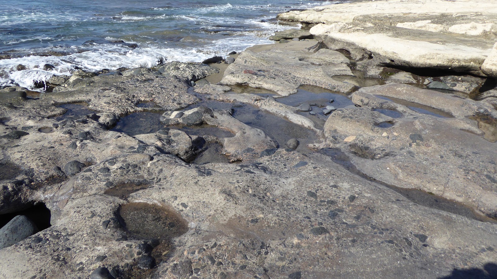
Strong winds and lime kilns
 |
| A walk south from Caleta de Fuste |
 |
| Looking back to Punta de Bajo |
 |
| The wider view of Caleta |
 |
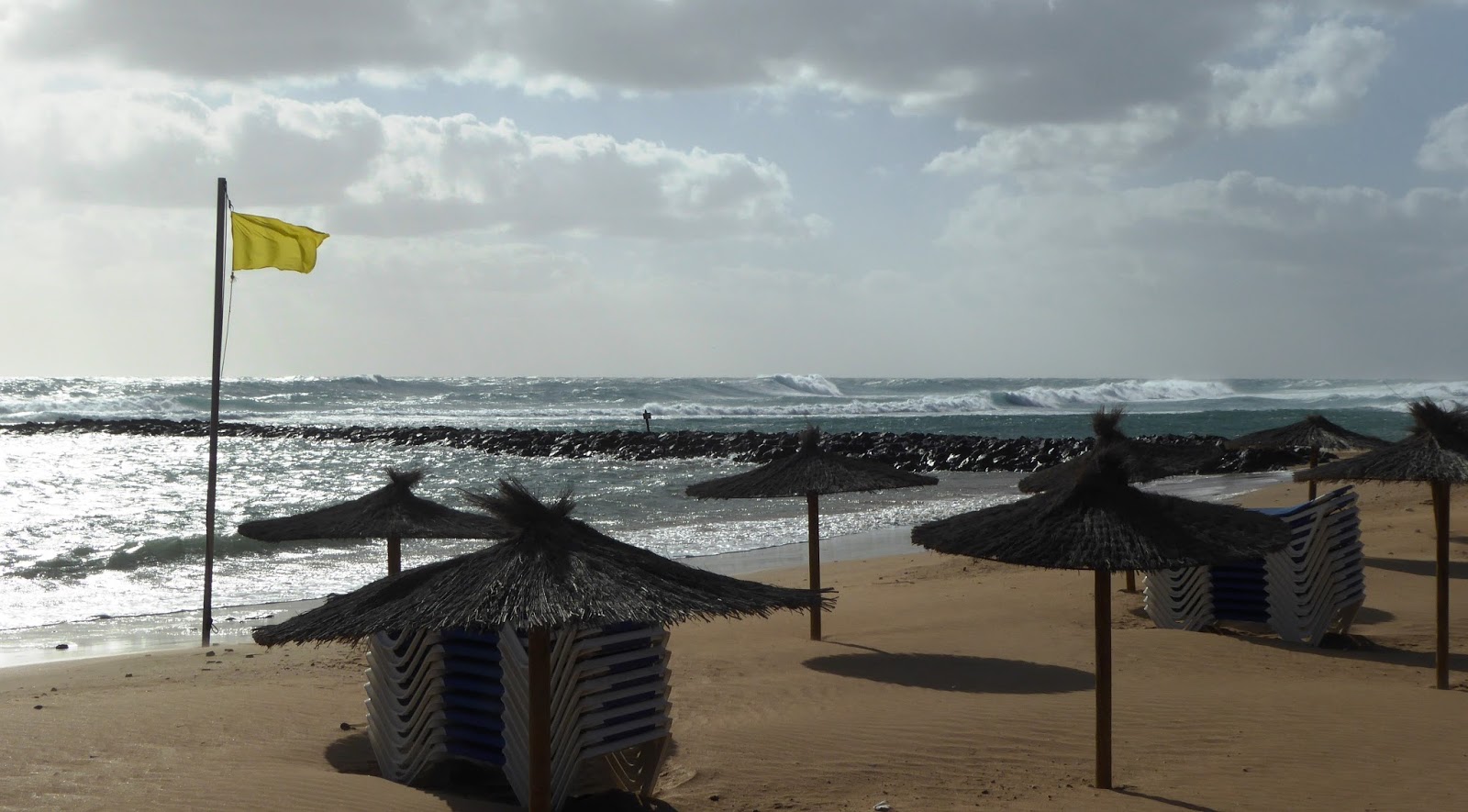
| Big waves and palm trees getting windswept |
 |
| Between Caleta and Las Corcobadas is more natural - no imported sand nor breakwaters, just blocky lava and sand. |
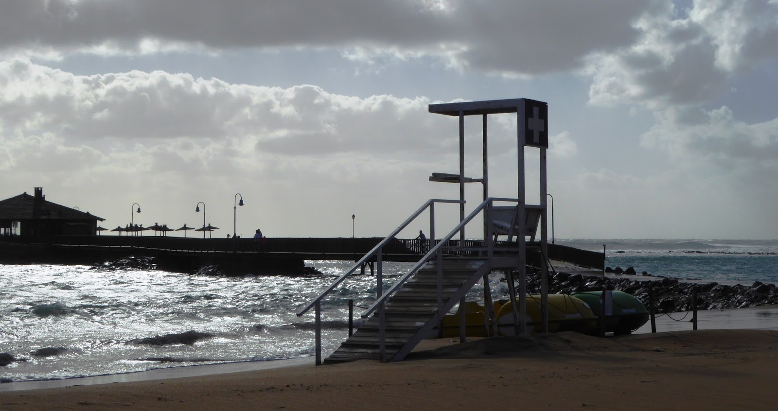
 |
| There's a series of moles built out to protect bathing areas, and each has its chiringuito or restaurant at the seaward end |
 |
| No bathers today - the December wind was strong and chilly! |
 |
| The sea flooding over the approach to the restaurant |
 |
| Sun loungers stacked and tied down |
At the southern end of the promenade, Caleta de la Guirre, are some kilns -
Hornos de Cal. I'm guessing that, in the absence of carbonate sediments in this part of the island the most likely source of lime was the thick caliche crust.
 |
| The beach by the Hornos de Cal de la Guirre |
 |
| Lime kilns |
 |
| Lime kiln |
 |
| Lime kiln |
Field day - Morro Veloso, Betancuria, Vega ring complex
 |
| The track and roadside exposures just below Morro Veloso - matching up plan views and sections of dykes |
 |
| Dykes in Morro Veloso road cut |
 |
| Displays in the mirador |
 |
| This section was particularly interesting as it showed ground water reservoirs, which tied in with the well we found at the Malpais Grande. (It does rather remind me of a poppadum cooked in the microwave!) |
To be continued...


 We spent some time scouring the area for shells and found that, whilst they were fairly abundant below the ruined houses, they were very sparse elsewhere. The shells are coated with pinkish caliche (calcium carbonate) which would have taken some time to be deposited. One of our hypotheses is that they are "kitchen midden" traces from the Maho civilisation.


No comments:
Post a Comment